Field Work Authority
Main Mission:
- Implementing 2D and 3D seismic geophysical surveys to explore hydrocarbon deposits to compensate for depleted oil and gas through eight seismic departments (crews) according to the Ministry of Oil plans for exploration areas and oil fields using the latest technology available in the world,
- Achieving the company's goals by clarifying the subsurface image of Iraqi state lands, in all types including desert, agricultural and submerged areas using various available methods and the sections of the division and specialized sections such as the drilling operations centre for seismic survey, a maintenance centre, a rehabilitation centre for various specialized equipment and devices
- Training of personnel in coordination with all the company's divisions and departments to work from the first to the last daylight, based on a shift work system, with a focus on production costs and a focus on the use of labour.
Structure:
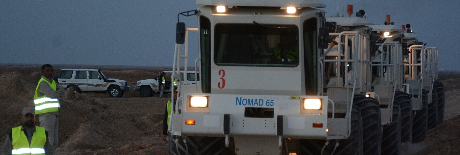
- Department of Seismic Crews (8 crews)
- 2. Technical Section
- 3. Follow-up Section
- 4. VSP Section
- Electronic Section
- 6. Drilling Operations Section
- 7. Maysan Operations Section
Work of Seismic Crews Department:
It is represented by the Seismic Crew Head and his deputies. It is divided into:
- Quality Control Section
- Recording Section
- Mechanics Section
- Administrative Section
Head of the Department:
- Following up on administrative matters personally regarding the staff, following up on mail for replies and correspondence, and providing all types of service (food, housing, water, etc.) in coordination with the crew administrator
- Following up on technical matters with all formations of the section
- Preparing a successful plan to implement the programs assigned to the crew in the best way and at the lowest costs
- Referring to government departments occasionally, if required, providing protection and overcoming any obstacles that occur during implementation of the crew program in the governorates, as well as communicating with OEC senior management in raising problems and obstacles to work
- Following up on productivity and quality on a daily basis through the daily work plan, and providing everything required by the work
- Following up on safety matters and ensuring the staff is committed to implementing safety conditions to ensure good conduct of crew staff and state the extent of the crew’s commitment to safety requirements
- 1. Quality Control Section
- Quality Control Unit:
Following up on surveying and deployment and pickup work, and working on Geoland and Geocluster systems
- Survey Unit
It performs the following:
- 1. Scouting Work
- 2. Camp Planning and Preparation Work
- Surveying Work
- 2. Recording Section:
- 1. Recording Unit:
- Receiving the SPS File from the Quality Control Unit for the points to be registered on
- Working in groups to deploy and pick up the FDU cable and the traces in the area designated for exploration
- Preparing the lines and connecting them to the recording device
- Preparing the connection between the vibrators and the recorders
- Recording Workshop Unit:
- Periodic inspection, maintenance and repair of field equipment geophone, cables, LAUX, LAUL
- Periodic inspection, maintenance and repair of Fiber Optic Transfer Cable
- Periodic inspection, maintenance and repair of LAUX & LAUL devices
- 3. Mechanics Section
- Vehicle Mechanics Unit:
- 1. Daily comprehensive inspection of all vehicles returning from work lines
- 2. Maintenance and servicing of vehicles, machinery and generators operating in the crew
- 3. Continuous training of the Mechanics Unit staff by people who have the experience and capabilities
- Receiving fuel and oils and following up on their monthly movement
- Receiving inventory materials from central stores and matching the movement of stored items
- Vibration Mechanics Unit:
- 1. Operator Work Procedures: Equipment inspection before and after operation according to Operator's form by the operators (at each operation)
- 2. Periodic Inspection Procedures: Periodic inspection of vibration equipment according to the mechanical inspection form by technicians (every two weeks)
- Maintenance and Sustainability Procedure, which is documented in Excel
- 4. Administrative Section:
Receiving the permanent imprest of the crew, coordinating the disbursement process with purchasing committees in the crew to maintain its work, and approving local and official purchase receipts in coordination with the Internal Audit and Control Department and the Financial Department according to the controls and powers transferred to the crew head, and supervising the work of the Administrative Unit, Journey Management Unit, Work Permits Unit, and Camp Boss Unit
- Administrative Unit
- Work Permits Unit
- Camp Boss Unit
- 2. Maysan Operations Site:
It serves as a store for field materials and equipment surplus to requirements of the seismic crews from its daily maintenance work to ensure their readiness to work when requested by one of the seismic crews.
- 3. Burjesiya Operations Site:
It serves as as a store for field materials and equipment surplus to requirements of the seismic crews and as a mechanical workshop supporting the seismic crews to maintain and sustain drillers and boats.
- 4. Follow-up Section: It consists of the following units:
- Administrative Unit:
Preparing all internal and external official correspondence related to seismic crews with (the company’s departments, the governorates, the Energy Police Directorate, the relevant security agencies, the governorates and all the oil sector companies) to facilitate the work of seismic crews.
- Bill Payment Audit Unit
Following up and auditing all monthly reports and financial matters, auditing bills, and following up on fuel expenditures.
- Technical Section: It consists of:
- Supervision and Implementation Unit
- Reports Unit
- Orders Unit
Supervising the preparation of orders, meeting the crews’ needs for materials, and analyzing technical offers for requests for recording materials, in addition to studying foreign contracts and organizing registration requests, following up on the work of seismic crews participating in the implementation of contractual projects and the progress of work on an ongoing basis, controlling field materials by organizing a central database of all seismic crews.
Vertical Survey Profile
The Vertical Survey Profile is one of the formations of the Field Operation Division and is distinguished by its specialized work through its formations of the only specialized crew affiliated with the Ministry of Oil concerned with surveying wells using vertical survey technology.
The crew tasks can be summarized as follows:
- Surveying exploratory wells using Zero Offset, Far Offset, Multi For Offset technology
- Contributing to solving geological problems facing extraction companies by applying pre-prepared programs according to a precise study to determine the stratigraphic problems of the well area and its surroundings
- Issuing a velocity model after processing vertical surveys, which contributes significantly to improving the geological studies of the fields and guiding drilling
- Defining the reflectors of the formations required to be studied, as it is possible to define them through the velocity survey for the well (Check Shot) and benefit from the more accurate definition of the stratigraphic and reservoir units within the formations, since the recording sampling is for every 7 metres and less
- Coming up with the best relationship between depths and velocities of all types vertically and laterally that extend 5 km to the two sides (seismic section)
- Obtaining secondary waves (S-Wave) with primary waves (P-Wave) which are important in studying elasticity coefficients of rocks
- Diagnosing gas reservoirs more precisely in clastic reservoirs by studying the elasticity of rocks by the Quantitative Interpretation application
- Determining fault and fracture systems within the seismic section during the interpretation of the vertical survey section and its integration with the seismic section passing through it
- Improving the velocities used in processing seismic information, especially in the migration stage (Depth Migration)
- Studying well pressures by applying the Seismic Pore Pressure technique in quantitative interpretations.
- The Vertical Survey Crew consists of two units:
- Well Logging Unit
- Well Logs Maintenance Unit
Electronic Workshop:
It consists of two units:
- Field Equipment Inspection and Operation Unit
- Field Equipment Repair and Maintenance Unit
Repair and maintenance of field equipment of all types and repair of (LAUL - LAUX) units and repair of field units (FDU) by national hands to save hard currency and follow up on the work of recording devices in seismic crews and be present in crews when needed.